

November 11, 2024
Chauncey Peak, Meriden
Mattabesett Trail, New England Trail
Notice, Relocation
September 16, 2021
Madison/Durham – Trail Relocation
Mattabesett Trail
Relocation
September 16, 2021
Berlin – Trail Relocation
Mattabesett Trail
Relocation
Details
Trail Length: 65 miles
Towns: Guilford, Durham, Madison, Haddam, Middletown, North Branford, Wallingford, Middlefield, Meriden, Berlin
Allowed Uses: Hiking
Partners: Connecticut Department of Energy & Environmental Protection (CT DEEP), Durham Conservation Commission, Guilford Land Conservation Trust, Middlesex Land Trust, National Park Service, Madison Land Conservation Trust, Berlin Land Trust, Wallingford Land Trust, Meriden Parks & Rec, Middletown Conservation Commission,
Trail Overview
The Mattabesett Trail (Mattabesett is the Indian name for Middletown) roughly forms a large horseshoe beginning at River Road in Middletown and extending to the Berlin Turnpike in Berlin. The trail begins traveling in a southerly direction, gradually becoming more westerly, and finally, assumes a northerly direction. The trail is one of the first trails conceived of by early Connecticut trail builders and remains a popular and highly visited trail today.
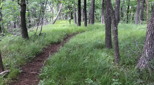
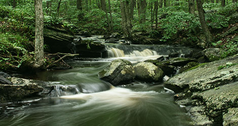
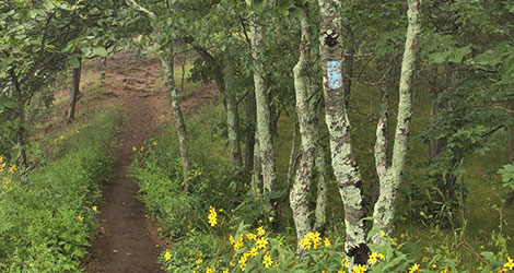
The eastern sections of the Mattabesett Trail contain high ledges and bald knobs with vistas of the Connecticut River. A picturesque terrain of tumbled ledges, frequent brooks, shallow bogs, vernal pools, mountain laurel, and hardwood forest add to the trail’s beauty. The western sections offer some of the finest ridge walking and cliff views in the state as the trail traverses the southern end of the traprock ridges that extend north into Massachusetts. Some of the notable features hikers will encounter include the Chinese Wall in Middletown, Pisgah Mountain in Durham, Bluff Head in Guilford, Beseck Mountain in Middlefield, Mount Higby in Middletown, and Chauncey Peak and Lamentation Mountain in Meriden.
The trail connects incredible open space across its length. State forests and parks, land trust preserves, municipal parks, and important conserved land are all linked by the trail. The Reservoir, Bear Hill and Seven Falls sections at the eastern end include 5 miles of loop trails. The trail intersects other major trail systems and offers additional loop opportunities in Millers Pond State Park and Mica Ledges in Durham, the Rockland Preserve in Madison, Braemore Preserve in Guilford, and Giuffrida Park in Meriden.
The Mattabesett Trail is part of the 220-mile New England National Scenic Trail (NET). The NET was designated as a national scenic trail in 2009 and connects from the Long Island Sound to the MA/NH border. The NET is comprised of the Menunkatuck, Mattabesett, Metacomet, and Metacomet-Monadnock Trails. A detailed resource for hikers is the NET Map & Guide. For more info about the NET, visit newenglandtrail.org.
- Hunting is permitted in State Forests and other properties intersected by this trail. Please use caution and wear orange during hunting season.