

Details
Trail Length: 6.2 miles
Towns: Newtown
Allowed Uses: Hiking Only
Partners: Connecticut Department of Energy & Environmental Protection (CT DEEP)
Trail Overview
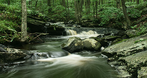
Located entirely within the 800-acre upper block of the Paugussett State Forest in Newtown, the Lillinonah Trail is surrounded on three sides by water. The trail parallels Lake Lillinonah, a 1,547-acre lake created in 1955 by the construction of the Shepaug Dam, which can be seen regularly from the trail. Another water feature is the Pond Brook inlet, a narrow waterway that stretches back to the trailhead at Hanover Road. The Lillinonah Trail is a rugged trail with frequent changes in elevation as it mostly follows the edge of the State Forest property. The Connecticut DEEP has designated a 3.1-mile section near the lakeshore as a scenic trail because of the excellent views of Lake Lillinonah, the Shepaug River inlet, the Shepaug Dam, and the three bordering towns on the lake (Newtown, Bridgewater, and Southbury). The trail also passes through an extensive sugar maple operation in the vicinity of the Echo Valley Rd parking area.
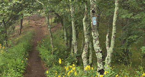
Within the forest are other multi-use trails. The Upper Gussy Trail, a 1.8-mile trail created for mountain bikers and equestrians, and Brody Road, named for conservationist Polly Brody (who convinced the State to purchase the land), both offer hikers numerous loop opportunities. Al’s Trail, marked with dark blue arrows, coincides with the Lillinonah Trail from the Pond Brook inlet to the trailhead near Echo Valley Rd. Visit the Al’s Trail website for more details.
- Hunting is permitted in the State Forest intersected by this trail. Please use caution and wear orange during hunting season.