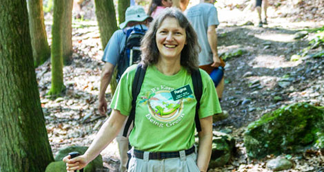
Meet Your Trail Host Hero
Interview with Adil Mulla, Mattatuck Trail Landowner
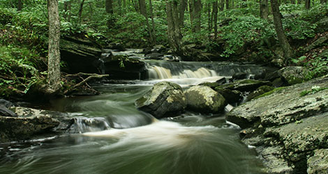
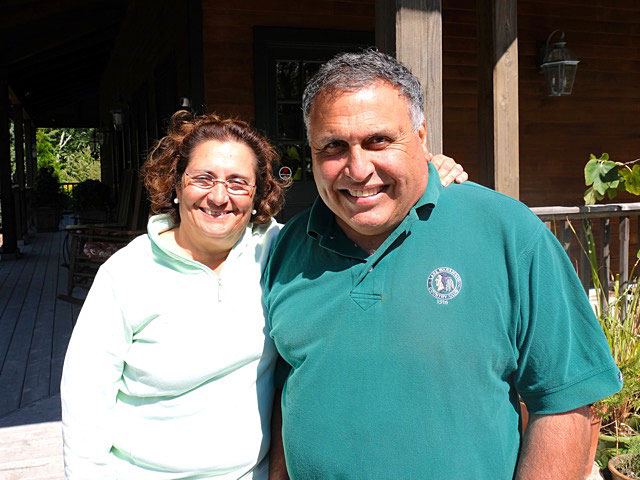
The Mattatuck Trail travels a rugged and diverse landscape featuring streams, ridges, ponds, and thick Connecticut woodlands. Adil & Zarinna Mulla own property hosting a section of the trail in Warren. Here’s the story of their land and Adil Mulla’s perspective on being a trail landowner. Thanks for being trail host heroes, Adil & Zarinna!
Adil, you gave CFPA permission to route the Mattatuck Trail through your property. Tell us a little about your land. What’s special about it to you?
“The 230 acres of beautiful forest land was acquired by me in 1996. It has a 3/4 mile eastern border and pre-existing trail that I gave permission to CFPA to weave the Mattatuck Trail through. I maintain that trail, which traverses a mixed hardwood/mountain laurel forest on my property. Several watershed streams cross the trail on their way to the Upper Shepaug Reservoir that lies a short way to its west. I had installed culverts so as to not divert their courses after consultation with the inland wetlands commission at the time. The property is uniquely stunning, both in beauty and history. I frequently invite groups like the Land Trust, garden clubs, and local residents to walk its other sections.”
What do you know about the history of your property?
“There are some interesting ruins of an old homestead from the 1700’s, an old abandoned cranberry bog (no cranberry bushes now but the drainage canal is still identifiable), a granite quarry from the 1700s, and the homesteaders also had several charcoal pits on the property. As far as the homestead is concerned, it seems to be from the 1700’s — old foundation, with a remnant stone fireplace probably quarried from the quarry up above about a half mile away. The homesteaders left a hand dug well about 15 yards from the home—still in reasonable condition—water at a depth of about 25 feet!
The quarry too is quite interesting: score marks and hand drilled holes are still visible on the old hillside granite outcrop. The granite is a pretty salt and pepper color when polished—it’s the same as that which was blasted out from my basement when I built my house in 2005. In fact, my kitchen countertops are made from it!
There is a portion along the eastern part of the property which was an old abandoned Christmas tree farm. Here, classic “forest succession” is on display (for those interested in forestry).”
How long have you lived in the area?
“I am fortunate to have grown up on and now reside on an adjacent property that was once a part of the old farm land. The piece that I co-own with an aunt and a cousin is 58 acres of ridgeline with wetlands at its base. An old woods road winds its way up the ridge. This road was used to access wood for fuel and the milling lumber for building on the farm. This became the Blue Trail at some point in the past. The trailhead for this piece has been relocated a number of times over the years. One section was moved due to trail degradation from ATV use and others because of their proximity to houses. ATV use has diminished but still is a problem at times.”
Have you noticed changes in the landscape over time?
“The character of the woods has changed a number of times over the years. The woods were once dominated by large hemlock trees, most of which have succumbed to woolly adelgids, although there seem to be a younger generation trying to get a new start. Ash trees plagued by the emerald ash borer have also been killed off. Beech trees seem to be the latest tree under assault. This has opened up the forest to allow light for more wildflowers to sprout. The dead trees have provided great homes for a number of birds and squirrels. Like the trees, the wildlife has its own cycles. Deer have always had a large presence. Coyotes and turkeys, which I never saw as a kid, are now commonplace. We have even sighted a fisher on the trail. A bobcat comes down off the trail and appears on the neighbor’s doorbell camera from time to time. Winter walks after a fresh snowfall are a great way to see what animals are making use of the trail. The number of different tracks along the same path can be surprising. I will often set up my trail cam to see what is active at night. Raccoons seem to be enamored with the camera, coming up to and directly looking into it. Deer, foxes, possums and the like do not notice and go about their way undisturbed.”
Sections of many of our most popular trails travel through privately owned land. What should hikers and other trail users be aware of when they use a trail that may cross private property? What advice do you have for them?
“All hikers should be responsible, never leave any litter on the trails, and use them respectfully. I also suggest that they report trail issues, like fallen trees.”
What’s your favorite thing about having a Blue-Blazed Hiking Trail on your land?
“Hikers are uniquely respectful of my property, and personally, I am blessed that people derive pleasure from hiking the trail through my land.“
Let’s be honest, hosting a hiking trail is not without its challenges. What issues have you had to deal with?
“Of course from time to time a hiker or two may accidentally wander off the Blue-Blazed Trail onto the other trails I maintain,”
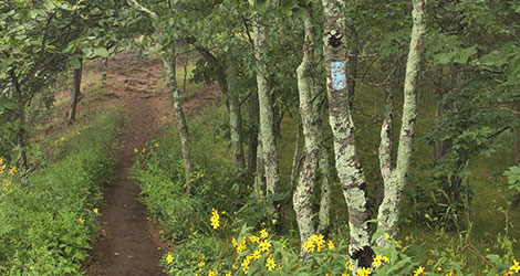
Protecting the Blue-Blazed Hiking Trails
You might assume our Blue-Blazed Hiking Trails are fully protected by being on conserved lands. The truth is our trails have crossed a mosaic of public and private lands since the establishment of the first Blue-Blazed Hiking Trail in 1929. Some of our most popular trails, such as the Mattatuck Trail, the Quinnipiac Trail, and the New England National Scenic Trail (to name just a few), have numerous and often lengthy sections on unprotected private lands. The landowners that own such lands graciously permit public access through their property, always free of charge and often without any recognition or even awareness by those that use the trails.
The private landowners that host our trails are as important for the long-term sustainability of our trails as ever. Without them allowing passage, the Blue-Blazed Trails would simply not exist as they do in their current form. Unfortunately, poor trail user etiquette, such as leaving behind trash, etc., jeopardizes public access to the trails we all love and puts an undue burden on those who own the land. So to shed a little light on the heroes that allow the trails on their land, we’re publishing a series of interviews with Blue-Blazed Hiking Trail landowners from across the state.